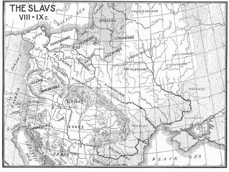
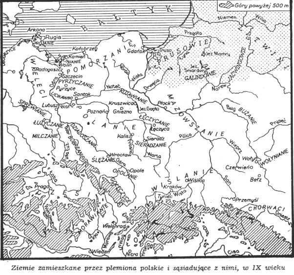
| This Polish map identifies the seven major West Slavic tribes (Wieleci/Veleti, Pomorzanie/Kaszubians, Polanie/Polanians, Mazowszanie/Mazovians, Wislanie/Vistulans, Czesi/Czechs, and Slowacy/Slovaks) which were prominent in the 9th Century as well as numerous, smaller West Slavic tribes. Two hundred years later, several West Slavic tribes were in the process of amalgamating to form the Polish nation. Most Russian anthropological sources place the originating point of the Slavic tribes
as the Pripet Marshes while Polish sources usually place the "Slav Homeland" as lying
between the Oder and Bug
Rivers. Personally, I lean towards the Pripet (Prypec) Marshes as being the "Slavic Homeland". |